Electric Route 66 Dashcam: Abandoned 66
Happy New Year!
With covid still raging, we continue to stay home and have not taken any recent road trips in The Blue Spirit. But that doesn't mean that I can't bring you another Route 66 dashcam video from our last trip to Arizona in October 2020.
 |
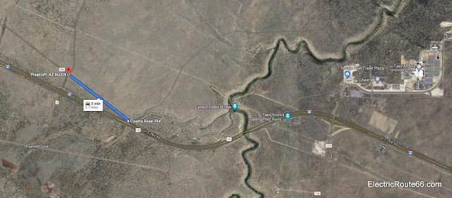
| This Google Maps aerial photo view shows the section of old Route 66 covered by the dashcam video. |
This time, we're traveling a very short section at low speed. This segment of Route 66 is west of Twin Arrows, and east of Winona. It was bypassed by a newer alignment of the road almost 70 years ago, around 1952. This is a dead-end section of 66 which was cut off by the construction of I-40. To proceed further east on the dirt access road (which was not 66), a high-clearance vehicle is required, which our Tesla is definitely not! It may have to wait until we get a Cybertruck to make it further east, where old 66 takes up again from the dirt road and crosses the abandoned Canyon Padre Bridge.
 |
| The Blue Spirit, pointed east toward piece of US 66 that was abandoned in the 1950s. |
Today's video is just over 5 minutes. We begin at a clearing next to I-40, with the dirt access road behind us, traveling westbound along degraded pavement to the old road's intersection with Angell Road less than one mile away. You can view the video embedded below, or follow this link directly to YouTube for more extensive viewing options.


Pretty smooth for an abandonded section of RT66. That would make a nice bicycle route. Hmmm didn't see any place to get a drink or energy snack so you would have to come prepared.
ReplyDelete